George Bush Intercontinental Airport (IAH)
Driving Directions / Travel by Car
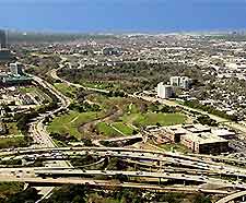
(Houston, Texas - TX, USA)
On the northern side of Houston, the George Bush Intercontinental Airport (IAH) lies alongside the city of Humble, in the Harris County area of Texas. The airport is located to the west of the US-59 (Eastex Freeway), with links to the Humble Westfield Road, the Will Clayton Parkway, Greens Road and the Sam Houston Parkway East. Central Houston can be reached in approximately 40 minutes.
To the west of Houston Airport, the Aldine Westfield Road skirts the perimeter of the complex and passes the Lochinvar Golf Club, running parallel to the Hardy Toll Road and the US-45 North Freeway.
A high number of golf clubs are close to Houston's George Bush Airport, the majority of which stand to the east and northeast, including the Kingwood, Deerwood and Walden courses. Also nearby, Lake Houston is a useful point of reference and is situated to the east, next to Huffman, Crosby, the Alexander Deussen Park and the Dwight D. Eisenhower Park, being spanned by the US-1960 highway.
Directions to George Bush Intercontinental Airport (IAH) from Houston city center:
- The airport complex is sited approximately 22 miles / 35 km to the north of downtown Houston
- Highway connections include the Interstate I-45 (North Freeway), Highway US-59, the Hardy Toll Road and the Sam Houston Toll Road (Beltway 8)
- The grounds have two main entrances, one from the Will Clayton Parkway and the other from the John F. Kennedy Boulevard
Houston George Bush Intercontinental Airport (IAH): Virtual Google Maps
